We kindly inform you that, as long as the subject affiliation of our 300.000+ articles is in progress, you might get unsufficient or no results on your third level or second level search. In this case, please broaden your search criteria.


The debate of the identification and definition of the askeri cifliks lies at the center of the Ottoman economic history. Their existence arises important questions related to the balance in the Ottoman classical economic and social system based on the state land property, the legitimacy of the political power of the Ottoman ruling class and the revenue collection of the agrarian surplus. A typical case of land usurpation and private control over the appropriation of the agrarian surplus can be investigated in the detail thanks to a wealth of historical data consisting of tax registers (tapu-tahrir defters), inventories of vakf's revenues and complaints against the ciflik-owner dated from 16th to the beginning of 18th century. The foundation and practice of administrator (mutevelli) of the Sofu Mehmed Pasha's and Mustafa Aga's vakfs (charitable donations), in the beginning of the 18th century demonstrates the genesis of such farms by occupation of abandoned lands. In addition, the investigation of the genesis and character of Veli Efendi's ciflik shows different ways of violation of the land law by the ciflik-owner as a result of his attempts at accumulating land, power and riches. The information included in the documents concerning the case of the ciflik presents the importance of political and economic factors such as the impact of the military campaigns on the population and the possibility of usurpation of abandoned lands as a result of the flight of the villagers for creating big askeri cifliks. The administration and control over the vakf's revenues and properties as part of the ciflik-holder's official duties are also of great significance for making high profits through concealing the ciflik's population and workers, misappropriation of arable lands and tax evasion. In other words the investigation of the case of the Veli Efendi's ciflik sheds light on the basic debatable questions in the Ottoman historiography related to the genesis and development of the askeri cifliks in the Ottoman Empire and some violations of the law and taxation by their holder, especially during 17th-18th centuries.
More...
The paper presents part of a hoard containing items of armaments, horse trappings and everyday objects discovered accidentally on the land of the village of Markovo, Shumen region. While inspecting the site of the discovery on the surface the author came across an array of heavily decayed iron items from tools, cattle-breeding equipment, animal bones as well as some fragments of building ceramics and pots of engraved linear decoration and polished strips from the VIII-th - X-th c. The Old Bulgarian signs engraved on some of them refer to the same period and have numerous analogies from Pliska, Madara and Preslav. Then the author assumed that a medieval settlement probably existed in the site of the discovery or the objects fell there by obscure circumstances most probably from the nearby large but insufficiently studied Hambarluk fortress from late Antiquity and the Middle Ages which came into existence in the V-th - Vi-th centuries and continued existing until the XIV-th c. The published materials by analogies fall withing the chronological boundaries of the early Bulgarian Middle Ages and specifically in the mid-X-th - late XI-th centuries.
More...
The village of Gintsi is located in Western Bulgaria, at the foothills of the Western Balkan Range and at about 50 km of Sofia. Once a road connecting Moesia and the river Danube with Sardica and Macedonia used to pass through the village. There were also fortifications around it, as evidenced by the toponym "Kaleto", relevant to two elevations at both sides of the route to Petrohan pass. According to a record dated from 1490, the village had an entirely Christian population, as did the entire area in the vicinity of Sofia. A Turkish register shows that the church in the village, that can be dated from the Middle Ages, continued to exist. According to its plan, the St. Nicholas of Myra belongs to the most widespread type of churches in Bulgarian lands in the Middle Ages and the National Revival, the single-naved basilica. The church has a semi-circular central apse inside and out, a naos and a narthex (added later). The entrance is one from the west, through the narthex into the naos. It has a barrel vault and has a gable roof with wooden casing and tiles, completely in the style of West Bulgarian single-naved churches in the period from the end of the 12-th to the 19-th century. The building technique is traditional for West Bulgarian lands. The material used was hewn and river stone, joint with white mortar. The church was decorated with murals. There were three distinctive period of decoration, with almost nothing remaining from the first murals. The murals are in three artistic layers.
More...
The author provides general characteristics for over a hundred of archaeological sites of the Golden Horde time on the territory of the Volga Bulgaria, such as forts, unfortified settlements and necropolises. He studies history of their research, area of distribution, topography of some sites, stratigraphy and chronology, archaeological material, and historical context of their emergence and development.Archaeological research of 19th—20th cc. detected at least 330 settlements — both fortified and unfortified. Best studied are forts, i. e. remains of towns and fortresses. Yet, only a small part of archaeological forts can be identified as historical towns mentioned in written sources. Thus, the article first studies towns known from written sources (with Bilyar and Bulgar as the largest ones), then the forts that emerged in pre-Mongol period and continued to exist over the Golden Horde time, and then the forts emerged during the Golden Horde time and unfortified settlements, and last — necropolises of late nomads on the territory of Bulgar Ulus. Necropolises left by the settled population are considered in parallel with the respective settlements.
More...
The city of Bolgar situated 50 km south from the Kama river mouth occupied an advantageous geographical position. Starting from 10th century, the territory, which had been closely connected with Bolgar throughout the entire period of its existence up to the early 15th c., began to develop around the city. This territory occupied both the left and the right bank of the Volga. After the Mongol invasion, the number of settlements in the area considerably reduced. The remaining ones, closely connected with Bolgar, gained further development and actively participated in the commodity-money relations of the Golden Horde Bulgar ulus.
More...
The author discusses features of the Middle Volga region historical development in the second half of the 14th to first half of 15th c., in the Golden Horde decline period. The specificity of the three climatic zones of the Middle Volga region, which determined the economic structure and the originality of the population’s material culture, is taken into account. Following the economic boom and the growing number of urban and rural settlements in the first half of the 14th century, a decline and urban life degradation are traced later, as well as the population migration to the north due to military conflicts and climatic changes. On the other hand, new settlements, cities included, emerged in the Middle Volga in the late 14th to first half of the 15th century as a result of the influx of the Golden Horde servicemen, the Volga Finns and the Russians. In the first half of the 15th century, independent Tatar fiefdoms, or beilyaks are established here, and simultaneously prerequisites for the emergence of independent states — Kasimov and Kazan Khanates — are formed.
More...
In the vicinity of Bilyar (“Great City”), the capital of pre-Mongol Volga Bulgaria, there are 249 archaeological sites referring to the 10th — first half of the 15th century. Of these, 59 date back to the pre-Mongol and the Golden Horde periods, while 20 archaeological sites refer exclusively to the era of the Ulus Jochi. The collapse of the Great City occurred in 1236. This fact is established by both written and archaeological sources and serves as another argument in support of the view that the coins with the name of al-Nasir li-Din Allah were minted in the 1240s. Recent studies have made it possible to localize the restored “Golden-Horde Bilyar”, where coins were minted in the second half of the 13th century, not on the site of the destroyed city, as was thought previously, but rather in the territory of the vast Bilyar III and the Toretskoye settlement sites located 3 km north-west of it. The number of settlements declined almost 3-fold — up to 8 persons per 1 sq. km, with a corresponding decrease in the population density. The changes in settlement patterns and material culture of the Bilyar area population, characteristic of the other conquered territories as well, reflects the process of provincialization of the former pre-Mongol centers.
More...
The paper discusses peculiarities inherent in formation and development of the administrative-territorial structure of the Volga estuary in the Golden Horde period, singles out economic micro-regions included in the Khan’s domain and offers geographical characteristics of the lower reaches of the Volga River, which had influenced the development of the Golden Horde cities and the formation of their suburbs.
More...
Are characterized monuments of the Middle Don region in the the Golden Horde period. They relate to different groups of population: are settlements with Russian ceramics and nomadic graves, mausoleums, burial grounds and settlements. New data of anthropological researches are provided. Comparison of data of archeology and written sources is carried out.
More...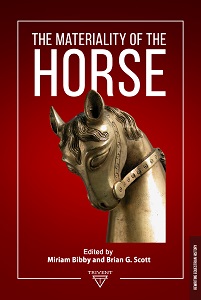
Ireland has nearly one hundred and seventy examples of cheek-pieces, two examples dating from the Later Bronze Age, the rest from c. sixth to seventeenth centuries AD, the great majority of which are of insular design and manufacture. There is a highly distinctive class that has been categorised as “horse pattern,” by far the greatest number being in the collections of the National Museum of Ireland, It is clear, however, from the basic anatomical details depicted that the animal incorporated into the design is a male deer, a red deer stag or a fallow deer buck. It is a distinct group, but one without immediate parallels, datable provenances or associations, and it is very difficult to find any convincing precursor inside or outside Ireland, or to use stylistic features to provide a reasonably close date-range. Metal analysis would tend to indicate later rather earlier mediaeval, a view that might be supported by ceramic motif parallels and, by the dating of the introduction of fallow deer to Ireland at the start of the thirteenth century AD.
More...
The prelatic sceptre is a symbol of strength and spiritual power. It imposes the obligation and responsibility to care for the integrity and preservation of the spiritual flock. The sceptre provides the bishop the power to judge and make decisions. The find from Trapezitsa is discovered in the big duplex building, in the civil complex near church № 3, in the Southeastern sector of the stronghold. The find has a biconical shape, with an almost flat upper surface. It’s quite possible that the workmanship is linked to a metropolitan studio. The entire surface features a “bird eye” ornament, applied circumferentially and also radially. Eight relief sheets are placed on the side surface. They are crafted in tall relief. From below the item ends with a bush for the attachment of the wooden stick. It remains an open question as to what kind of a representative of the metropolitan aristocracy was the complex in question meant for – a high-ranking layman or a clerical individual? The bone end of the prelatic sceptre is an important find, which links the new-found civil complex of Trapezitsa with a high-ranking representative of the metropolitan ecclesiastical hierarchy.
More...
The Great Flood is a legendary story known from many ancient civilizations. The general idea is that the gods or god decide to destroy sinful humanity, but in the end they spare it by leaving a representative to repopulate the earth. Hardly anyone has not heard of the biblical Noah, God’s chosen one who survived the flood, but few know that long before history was recorded in the Bible, there was Ziusudra – the chosen one of the Sumerian gods who decided to destroy humanity as they unleash the waters and flood the earth. This paper presents a historical, geographical and substantive description of the cuneiform tablet revealing the history of the flood. Examples of other Sumerian cultural artifacts related to the myth are presented, as well as analogies with civilizations far and close to the Sumer, which in turn brings information about international relations in antiquity and the significance of a history present in human global civilization over the millennia.
More...