We kindly inform you that, as long as the subject affiliation of our 300.000+ articles is in progress, you might get unsufficient or no results on your third level or second level search. In this case, please broaden your search criteria.


Inside the New Europe, proposed to reorganize based on cosmic principles instead of some arbitrary decisions, it’s possible to create five administrative-territorial unities, with grouping of the existent national states, -enclaves and –exclaves, of which functioning follows a damped harmonic oscillator model, taking part in the forming Eurasian Continental Unity. The Carpathian Chain being the terrestrial projection of the Constellation Draco/Dragon, with the included Ecliptic Centre represented by the Rosia Poieni Peak in the West-Carpathians, results of course the forming around it the Central-East European Territory, bordered by the Baltic Sea to the North, the Mediterranean Sea to the South, the Black Sea and the rivers Nistru-Bug to the East, and by the limits of the Central-West European Territory (former German-Roman Empire) to the West, with which together are forming the New Central Europe, surrounded by the West-, North- and East-European Territories, each of them with Northern- and Southern parts. Thus, the Central-East European Territory, called DRAKYA according to the Constellation, is separated by the river Danube-Drava in North-Drakya=DAKYA and South-Drakya=TRAKYA. DAKYA is relatively simple to realize, extending the V4 Association of Czech-land, Poland, Slovakia and Hungary with ROMANIA and MOLDOVA, respectively including the intercalated small teritories, but TRAKYA is more difficult to border inside the Mediterranean Sea. The coordinating centre of DAKYA results of course by cosmic criteria, through realizing of the new spatial town ROSIA POIENI, with residential and agreement zones on the surface, and with production and communal services in the depth, including a transatomic work too. A similar coordinating centre is possible to realize in TRAKYA at the Olympos Mountain, which is the projection of the Thuban, first star of the Constellation. In this conception, the functioning of the whole system is proposed with a periodicity of 5 years, started in 2020 with DRAKYA and TRAKYA, and from 2030 following with our western neighbours, and in order the West-, North- and East-European territorial ones, so in the next 100 years will be functioning the complete system with its mechanism based on equality, equilibrium and harmony, making certain the long-term evolution, after 2120 in cicles of 30 years. This transition from the „bulk” or atomized Europe to the proposed new structure, coincides with a transition process to a higher level of our consciousness, through a cosmic thought in general, inclusive in our renewed architectural and urbanistic thinking. In Europe’s restructuring based on cosmic principles, after their outside positions, ROMANIA and MOLDOVA will have a central position and coordinating role, with the possibility to catch up – or exceed – the more advanced European countries, restructuring their slender infrastructure and settlement network, as a result of their better situation in the domain of resources. In the realizing process of this grandious programme, a prime role will have the institution INCD-URBAN-INCERC, with its complex profile, able to coordinate on long term
More...
The author provides general characteristics for over a hundred of archaeological sites of the Golden Horde time on the territory of the Volga Bulgaria, such as forts, unfortified settlements and necropolises. He studies history of their research, area of distribution, topography of some sites, stratigraphy and chronology, archaeological material, and historical context of their emergence and development.Archaeological research of 19th—20th cc. detected at least 330 settlements — both fortified and unfortified. Best studied are forts, i. e. remains of towns and fortresses. Yet, only a small part of archaeological forts can be identified as historical towns mentioned in written sources. Thus, the article first studies towns known from written sources (with Bilyar and Bulgar as the largest ones), then the forts that emerged in pre-Mongol period and continued to exist over the Golden Horde time, and then the forts emerged during the Golden Horde time and unfortified settlements, and last — necropolises of late nomads on the territory of Bulgar Ulus. Necropolises left by the settled population are considered in parallel with the respective settlements.
More...
The article represents a study of the topography of the Golden Horde town of Azak, which has remained quite underresearched until present. In the 18th — first half of 20th centuries, the hillfort did not attract attention of the Russian historians and archaeologists. Nowadays the territory of the Medieval Azak is completely built-up and archaeological investigations of 20th — early 21th century have been conducted on separate sectors, mainly in the new construction zones. According to the results of research, one can determine the borders of the Medieval town at different stages of its existence. The author discusses different aspects of the economic development of Azak as well as peculiarities of urban development. He localizes various social, professional and ethnic population groups within the town’s territory, together with common buildings, sources of water supply, town necropolises, fortifications and so on.
More...
The author discusses features of the Middle Volga region historical development in the second half of the 14th to first half of 15th c., in the Golden Horde decline period. The specificity of the three climatic zones of the Middle Volga region, which determined the economic structure and the originality of the population’s material culture, is taken into account. Following the economic boom and the growing number of urban and rural settlements in the first half of the 14th century, a decline and urban life degradation are traced later, as well as the population migration to the north due to military conflicts and climatic changes. On the other hand, new settlements, cities included, emerged in the Middle Volga in the late 14th to first half of the 15th century as a result of the influx of the Golden Horde servicemen, the Volga Finns and the Russians. In the first half of the 15th century, independent Tatar fiefdoms, or beilyaks are established here, and simultaneously prerequisites for the emergence of independent states — Kasimov and Kazan Khanates — are formed.
More...
In the vicinity of Bilyar (“Great City”), the capital of pre-Mongol Volga Bulgaria, there are 249 archaeological sites referring to the 10th — first half of the 15th century. Of these, 59 date back to the pre-Mongol and the Golden Horde periods, while 20 archaeological sites refer exclusively to the era of the Ulus Jochi. The collapse of the Great City occurred in 1236. This fact is established by both written and archaeological sources and serves as another argument in support of the view that the coins with the name of al-Nasir li-Din Allah were minted in the 1240s. Recent studies have made it possible to localize the restored “Golden-Horde Bilyar”, where coins were minted in the second half of the 13th century, not on the site of the destroyed city, as was thought previously, but rather in the territory of the vast Bilyar III and the Toretskoye settlement sites located 3 km north-west of it. The number of settlements declined almost 3-fold — up to 8 persons per 1 sq. km, with a corresponding decrease in the population density. The changes in settlement patterns and material culture of the Bilyar area population, characteristic of the other conquered territories as well, reflects the process of provincialization of the former pre-Mongol centers.
More...
The paper discusses peculiarities inherent in formation and development of the administrative-territorial structure of the Volga estuary in the Golden Horde period, singles out economic micro-regions included in the Khan’s domain and offers geographical characteristics of the lower reaches of the Volga River, which had influenced the development of the Golden Horde cities and the formation of their suburbs.
More...
Are characterized monuments of the Middle Don region in the the Golden Horde period. They relate to different groups of population: are settlements with Russian ceramics and nomadic graves, mausoleums, burial grounds and settlements. New data of anthropological researches are provided. Comparison of data of archeology and written sources is carried out.
More...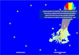
The chapter presents an analysis of theRomanian social house in an European context.
More...
The fundamental goal in approaching multimodality in transport is to integrate all modes of transport in an optimal, sustainable and ethical system. The implementation of intermodal services in the field of tourism will contribute to the increase of travel options, as well as to the provision of comfortable services, while increasing the efficiency of the transport system as a whole. The objective of the research is to identify and evaluate efficient IT solutions for calculating travel times in the integrated combined transport system of national road and rail infrastructure and the forecast demand in the field of public transport of people to tourist destinations. The proposed methodologies for defining IT solutions are based on the use of Geographic Information Systems, both in vector format corroborated with data on general transit specifications (GTFS) and in raster format by creating a continuous cost surface model, using all transport nodes.
More...
Development regulations are organizational tools and basis for shaping the character of current cities and the form of its development. The efficiency of these regulations, their inclusiveness and flexibility, in addition to their ability to adapt to the needs of the present and future, directly affects the shape and quality of the built environment. The paper discusses conventional development regulations used today, from a critical point of view, and presents form-based codes as an alternative to the former, conducting a comparative study between both types of regulations. Finally, the research recommends taking advantage of form-based codes in creating meaningful places and not just buildings.
More...
Based on the proGIreg case study, the potential use of neighbourhood-based nature-based solutions for urban regeneration is presented. The classification of the specific solutions of the project (compared to other classifications) will be presented, together with the critical conclusions on why NBS are relevant for the emerging new concept/approach of Biophilic Urbanism. One of the results of the applied research project is the Replication Toolkit - which aims to facilitate the implementation of Nature-based solutions for other cities. The Replication Toolkit contains a set of recommendations for the strategic component of urban regeneration of post-industrial neighbour-hoods, but also for the operational component of concrete implementation of solutions.
More...
Cula is a semi-fortified construction, characteristic of the 18th-19th century. Such construction can also be found in other countries, such as Serbia, Bulgaria, Albania, Greece, and Northern Macedonia. In Romania, there are several dozen calls, with different levels of conservation. Until now, these constructions have not been exploited for tourism, most being left to decay. Establishing cultural routes that include them could represent a solution to save these constructions.
More...
The integration of nature in urban cities is part of ancient planning. Its role was limited to relaxation, leisure and health, but this concept has evolved rapidly in recent years with the emergence of ecosystem services in the light of a green infrastructure approach. Researchers have become increasingly interested in this concept recently with the aim of improving the quality of life of inhabitants in particular by identifying ecosystems that provide economic, social, and environmental services in order to ensure the sustainability of the city. Our research goal is to know these services in order to meet the challenges of sustainable urban development.
More...
The Covid-19 pandemic has had a profound impact on cities around the world, transforming the way urban dwellers live, work, and interact with each other. As a result, the pandemic has also affected the identities of cities, or how urban areas are perceived by their residents and visitors. In this paper, we will explore the effects of the Covid-19 pandemic on urban identity, looking at how the pandemic has changed the way people relate to cities and how cities have adapted to the pandemic.
More...
Many Algerian cities, including Biskra, suffer from natural problems, especially those caused by heavy rainfalls due to climate change, which reaches its maximum for a long period, and causes severe damage in terms of human and material losses. This paper draws attention on how to deal with the adverse effects of rapid and sudden floods due to runoff in the city of Biskra by studying the green infrastructure as means that rely on preserving the hydrological cycle of water in the safe and effective stormwater management of urban areas and prove that there are opportunities for the application of green infrastructure solutions not only to solve social and economic problems, but also environmental ones. Stormwater management and flood control are among the solutions provided to avoid the negative effects of urban floods, especially in areas with fragile infrastructure.
More...
This study specifically analyzes the MENAT area (Middle East and North Africa plus Turkey) using images collected during self-funded on-site documentary studies to look at the public space. The analysis included Morocco, Algeria, Tunisia, and Egypt in Africa, and Turkey and Jordan in Asia. The analysis found out a gradient starting with well designed public spaces in the large cities, down to a lack of care for the public space, seen often as “no one’s land” in informal settlements and small cities. These contrasts between countries, within the same country and even within the same city are a common feature of the analyzed area.
More...
This article explores the concept of smart growth by examining its definitions, principles, and perspectives through relevant literature, EU policies, and international practices. It highlights the importance of smart growth in promoting urban sustainability, stimulating economic development, and improving quality of life. Additionally, it addresses the challenges and opportunities associated with implementing this concept across various geographical and social contexts.
More...