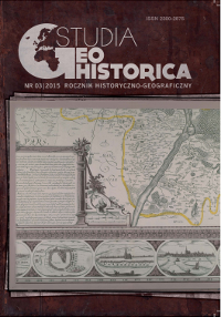
Ruiny zamków i grodzisk z obszaru Warmii biskupiej na mapie Kaspara Hennenbergera z 1576 r.
The Ruins of Castles and Strongholds in the Area of Warmia Bishopric on the Map by Kaspar Hennenberger (1576)
Author(s): Robert KlimekSubject(s): Historical Geography, 16th Century
Published by: Polskie Towarzystwo Historyczne
Keywords: Kaspar Hennenberger;Warmia;grodziska;ruiny zamków;strongholds;ruins of castles
Summary/Abstract: In 1576, in Königsberg the first detailed map of the Duchy of Prussia by Kaspar Hennenberger (1529–1600) was published – Prussiae, das ist das Landes zu Preussen welche herrliste Theil ist Sarmathiae Europeae eigentliche und warhaff tige Beschreibung. It played a prominent role in the history of cartography of that area and as long as until the middle of the 18th century it provided the basis of the maps of Prussia published in the west of Europe. Hennenberger made his map mainly basing on his own measurements and materials collected in the years 1569–1576, during a 7-year-long journey around the country. On the basis of the measurements, the map’s scale is 1:368 000. Numerous editions and modifications indicate the value of the map and a need for it. It was as early as in 1595 that it had the second edition supplemented with a broad historical description. Th e subsequent editions appeared in 1627, 1629, 1638, 1639, 1655 and 1679. The picture of the settlement network is characterized by the greatest variety of presentations. An important iconographic symbol in Hennernberger’s maps, which is however frequently neglected in the literature of the subject, are the marks in the shape of mounds with a cross, in the map key described as – Ein Berg da vor alters ein Schloss drauf gewesen – which means a hill where a castle (a hillfort) was situated. In the map Prussiae, das ist das Landes zu Preussen Hennenberger placed 55 symbols signifying this type of structures. He placed most of them, namely 6, in the area of Śniardwy lake and 5 in the vicinity of Insterburg. In the territory of the Bishopric of Warmia Hennenberger provided symbols for four constructions: Sądyty (Sanditten) near Olsztyn, Bogdany (Sonnenberg) near Frombork, Grzęda- Pleśno – (Sturmhofel) near lake Sajno (Zain See) and the ruins of a castle in the area of the town of Biskupiec (Bischburg). Th e present paper also discussed the defensive constructions in Pilec (Pitlzen), which was under the jurisdiction of the bishop of Warmia till 1374. Th e analysis of the placement of symbols in Hennenberger’s maps in the area of the Warmia dominium points out that they are confirmed either in the area, e.g. hillforts in Bogdany and in the Citry Forest of Olsztyn, or in written sources such as the castle in Biskupiec and a watchtower in Pilec. The defensive constructions near lake Sajno have not survived till now. However, field verifications, especially those from the first half of the 19th c. point out that they existed. Th e matter of the localization of the castle in Biskupiec still remains open. So far, it has not been noticed in the literature of the subject that Hennenberger marked the ruins of that defensive construction in the north-eastern part of the town, on the left bank of the river Dymer. Nearly 50 more symbols from Hennenberger’s map remain to be analyzed. It seems that after a thorough research of the sources and in the field we will find out that some of them hide many a forgotten historical mystery.
Journal: Studia Geohistorica
- Issue Year: 2015
- Issue No: 3
- Page Range: 46-60
- Page Count: 15
- Language: Polish

