We kindly inform you that, as long as the subject affiliation of our 300.000+ articles is in progress, you might get unsufficient or no results on your third level or second level search. In this case, please broaden your search criteria.
The article is based on the field research the author undertook in the regions of Tibet and Nepal. According to the recent findings by Ermakov, Kværne and Samuel, as well as the author’s opinion, the name Bön carries multiple meanings. Primarily it refers to the lost religion or Ancient Bön, which was the dominant religion over a wide region of Azia before the onset of Buddhism. Secondly, there was the Yungdrung Bön, which consisted of a large number of rituals which were supposed to improve the world, ease the burden of everyday life and finally lead the follower to higher learnings which, in the end, result in the enlightenment. On the third place, there is Bön Sarma, frequently referred to as the New Bön.
More...
Osmaneli District is situated in Southern Marmara subregion within the borders of the Marmara Region. It is bordered by İznik (Bursa) and Pamukova (Sakarya) districts to the north, Geyve (Sakarya) and Gölpazarı (Bilecik) to the east, central district of Bilecik to the South and Yenişehir (Bursa) and İznik to the west. The district is comprised of one district and 27 affiliated villages in administrative terms with a surface of approximately 526 km² in total. This study was carried out on villages of Osmaneli district from the settlement geography. It is aimed at exploring similarities and differences between socioeconomic characteristics of the villages in the light of physical and human environment. In this scope, village settlements around Osmaneli were investigated by their name, location, elevation steps, settlement patterns, situation in respect to the forest, surface and size, economic activities and changes of site. As a result, it was found out that distribution of the village settlements is affected mainly by geomorphologic characteristics followed by physical factors such as water supply, soil and climate conditions as well as economic activities, transportation costs, security and defence and also historical and psychological factors. While doing this, cause and effect relation and mutual relationships were considered in distribution of events and settlements departing from determinism, distribution and connection principles, which are foundations of the geographical thinking. The study is supported with pictures, figures, tables and distribution maps in order to make the results clearer. The maps used in this study were obtained in the digital media on the ArcGIS by using the GIS method for improved better reliability and validity.
More...
The present paper is a preliminary study regarding an early Vinča anthropomorphic figurine discovered in site of Limba-Oarda de Jos during the archaeological campaign from 1997. The description of the type, the manufacturing technologies, the specific anatomical features, the specific characteristics are presented by the author. Finally, are advanced, generically, some assumptions most frequent disseminated in the literature regarding the significance of these artifacts, respectively short interventions with similar findings analogies from Transylvania and Banat. Regarding the artistic aspect, we note different trends. The artist drew a particular attention to some parts. Anatomical elements are sometimes represented accurate, with an overflowing realism, while others are rendered sketchy, geometrical, leading to abstraction. In the case of Venus from Limba, we noticed a harmonious junction between Starčevo and early Vinča elements, all of them showing a balanced symbiosis, a mixture of two conceptually different patterns where Vinča elements tend to impose (by triangular mask oriented up, by flatting of top of head which form the upper edge of the mask, by the arms construction in an original manner with means of wooden rods which remained well-shaped imprinted; by the loss of the Starčevo elegant forms in the benefit of Vinča brutal forms, more massive, respectively by typical Vinča ceramic clay).
More...
A review of a recent edition of the travel diaries of the German geographer Eugen Oberhummer, with a special emphasis on his travels to Cyprus in 1887 and 1891.
More...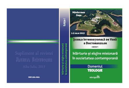
The present study, ‘Christian Mission in the Territories of Today’s Romania and Slovakia in the 6th-10th Centuries, Based on Archaeological Finds’, deals with the period of the so-called ‘dark centuries’ in the history of Christianity in the territory of today’s Romania, approximately between the years 620 and 900. Despite the fact that many attempts have been made to find, in this territory, the traces of organized Christian communities, there is very little evidence available; that is why, in Romanian historiography, they speak of the ethnogenesis of the Romanian people formed at the time of the migration waves. The author of this study tries to point at the archaeological evidence of some Romanian settlements from this period, showing that, at the time, there existed well-organized communitites, whose inhabitants would use the Romanian or Latin language and who had a strong Christian identity, although not always belonging to main stream Orthodoxy. These are, in particular, the organized communities in Dobrogea and in the western part of the Carpathian Mountains (in the region close to the city of Nitra in today’s Slovakia).
More...