We kindly inform you that, as long as the subject affiliation of our 300.000+ articles is in progress, you might get unsufficient or no results on your third level or second level search. In this case, please broaden your search criteria.

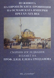
This study, based on the ground of unpublished Ottoman tax registers (tapu tahrir defterleri), analyses the "population-area" relationship in the Sakar Mountain and the adjacent area in the 15th-16th century. After detailed selection and translation of the Ottoman tax registers and analysis of the information in terms of settlements, as identified in the registers, the borders of the kaza of Edirne have been established as well as the changes which occurred in that territory; the extent and methods of occupying this administrative area and the ethno-religious structure of the population, within the studies region, have been specified. It has been found that the East, West and North borders of the region of Edirne did not undergo significant changes in time. Only the South border was changed over the years, including towns and villages, adjacent to the kaza of Dimetoka. A typical feature of the settlement network, withing that region, was its instability at the end of 15th and the first half of the 16th century. The small weak settlements prevailed in it - probably still newly populated areas, founded when liberated slaves or colonized population settled the area or they were just old settlements in decline. Int the second half of the 16th century the settlement network became stable and strong and increased its density. Within the period 1485-1570 most densely populated was the area with and altitude of up to 250 m. Together with the process of settling the lowlands another process was taking place - settling of the foothill and the mountain areas of the region. The towns and villages, located in the investigated region, were occupied by Muslims and non-Muslims, as the total number of the households of both religious communities gradually increased in the years.
More...
Sixteenth century is the time of dramatic expansion and demographic changes for the Ottoman Empire. A certain impact on people's everyday life has the environment and more specifically environment consequences in the means of increasing population, changing patterns of production, transitions from nomadic to settled agriculture communities. The village territory and the peasants' agrarian activities are of great importance for the economic history researchers, ethnologists and scholars interested in the Ottoman Empire and more specifically in the reclamation of the agrarian space. The present paper examines the procedure on fixing the boundaries of the village territory as it was recorded in the judicial records - huccets, included in the detailed (mufassal) defter of 1570 containing information on the vakifs of Pasa sanack. The judicial records refer to the village territories of four settlements - Kul Ibrahim, Sruca Reis, Boazkesen and Hizir bey on the territory of the kaza of Stara Zagora during the 16th century. The examined copies of huccets give detailed information about the two main elements of the village territory - arable lands and pastures, but also provide data on the environment of parts of the territory of the kaza of Stara Zagora.
More...
The image of Ottoman invasion of the Bulgarian lands, the Tarnovo Patriarchate, in its capacity as the "Mother of All Bulgarian Churches", maintained international contacts throughout the Greek Orthodox world. The Patriarchate enjoyed high prestige among Orthodox Slav on account of its consistent anti-Unite stance, adopted after the Church Union of the Council of Lyons (1247). This stance differed drastically from the contradictory policy of Byzantium and the Church of Constantinople which were inclined to make compromises with the West and the Papal institution in Rome as part of an attempt to forge an alliance and oppose the invading Ottoman forces. The Tarnovo Patriarchate strongly adhered the Orthodoxy and resisted Roman Catholic attempts at penetration in the territories under its pastoral care. The Bulgarian Orthodox Church by all probability had a major role in spreading Christianity among Cumans and some Tatars in Wallachia and Moldova in the 13 th and 14 th centuries . The high status of the Head of the Tarnovo Patriarchate was borne out by the participation of Patritach Simeon in the coronation of the Serbian monarch Stephen Dusan (1331-1335) and his Bulgarian wife Elena as Tsar and Tsarina and the transformation of the Serbian Archbishopric into a Patriarchate in 1346. Around the middle of the 14th c. the Tarnovo Patriarchate was established contacts with Russia. In 1352 Patriarch Theodosius II of Tarnovo took part in the ordination of Theodorit, Metropolitan of the Principality of Galicia-Lithuania, as Metropolitan of Russia. For Russia Tarnovo was obviously an important spiritual centre holding authority over all Orthodox Slavs. At more or less the same time we encounter the appellation "Tsarigrad-Turnov" which reflected the idea of the Bulgarian capital as a "Third Rome" and "Second Constantinople". Further proof of the high status of Bulgarian clerics among Orthodox Slavs is provided by the enthronement, in the year 1375, of three patriarchs originating from Tarnovo: Euthymius (Evtimii) of Tarnovo (1375-1393), Ephraem of Pec, Patriarch of Serbia (1375-1380; 1389-1392), and Cyprian, Metropolitan of Kiev and all of Russia (1375-1406). The survey of Bulgarian-Russian spiritual ties presented above aims at correcting a view still current in historiography according to which, between the 16th and 18th centuries, church influence followed a North-South (rather than a South-North) axis. While we may assume that such a view reflects the state of affairs in the 18th century, the earlier times of Ottoman domination (15th-17th cc.) were marked by attempts on the part of Tarnovo clerical elite to take part in the most important initiative aiming to increase Russia's prestige as the only independent and most powerful Orthodox Slavonic state. Higher clerics made a point of mentioning the names of Russians monarchs in church services intended for Bulgarian Christian congregations and thus seered Bulgarian expectations of political liberation in the direction of Russia.
More...
The author discusses features of the Middle Volga region historical development in the second half of the 14th to first half of 15th c., in the Golden Horde decline period. The specificity of the three climatic zones of the Middle Volga region, which determined the economic structure and the originality of the population’s material culture, is taken into account. Following the economic boom and the growing number of urban and rural settlements in the first half of the 14th century, a decline and urban life degradation are traced later, as well as the population migration to the north due to military conflicts and climatic changes. On the other hand, new settlements, cities included, emerged in the Middle Volga in the late 14th to first half of the 15th century as a result of the influx of the Golden Horde servicemen, the Volga Finns and the Russians. In the first half of the 15th century, independent Tatar fiefdoms, or beilyaks are established here, and simultaneously prerequisites for the emergence of independent states — Kasimov and Kazan Khanates — are formed.
More...
The paper discusses peculiarities inherent in formation and development of the administrative-territorial structure of the Volga estuary in the Golden Horde period, singles out economic micro-regions included in the Khan’s domain and offers geographical characteristics of the lower reaches of the Volga River, which had influenced the development of the Golden Horde cities and the formation of their suburbs.
More...
Are characterized monuments of the Middle Don region in the the Golden Horde period. They relate to different groups of population: are settlements with Russian ceramics and nomadic graves, mausoleums, burial grounds and settlements. New data of anthropological researches are provided. Comparison of data of archeology and written sources is carried out.
More...
În cazul lui Zamfir Arbore – mare personalitate istorică, militant împotriva monarhismului imperial rus şi luptător pentru unirea Basarabiei – recursul la trecut s‑a impus ca o necesitate, ca o întreprindere cu adevărat benefică, de revigorare a memoriei ştiinţifice a vremurilor în care a trăit, vremuri construite pe verticala devenirii naţionale moderne. În acest sens, Dicţionarul geografic al Basarabiei1, pe care l‑a publicat în anul 1904, a marcat un imperativ în acelaşi timp istoriografic, politic şi naţional, majoritatea covârşitoare a informaţiilor cuprinse în această lucrare fiind valabile şi astăzi, prin calitatea de adevăr ştiinţific.
More...
Un sumar bilanţ al activităţii portului Bugaz pe parcursul celor aproape opt ani, între redeschiderea traficului şi cedarea ocupantului sovietic, relevă rezultate pozitive pe mai multe paliere. Populaţia locală şi cea din hinterlandul portului, care a cuprins o regiune de 100 km din sudul Basarabiei, a beneficiat de un debuşeu pentru exportul produselor cerealiere, cu preţuri avantajoase şi stimulative. Navigaţia între Marea Neagră şi limanul Nistrului s-a îmbunătăţit ca urmare a amplasării balizelor şi instalaţiilor de acostare a navelor. De aceste facilităţi au beneficiat nu numai navele care veneau la încărcat, ci şi pescarii din zonă. Numărul locurilor de muncă, stabile şi temporare, a crescut. Portul Bugaz a provocat o mişcare economică şi comercială în sudul Basarabiei cu efecte în îmbunătăţirea transporturilor pe apă cu porturile Constanţa şi Sulina, de unde cerealele luau drumul spre pieţele din Orientul Mijlociu şi Occident. La Bugaz s-a derulat o activitate „determinată şi condusă în spirit naţional românesc”, într-o zonă cu o populaţie eterogenă şi cu o utilizare pentru comunicare „din ce în ce mai întinsă a limbii româneşti” . Indubitabil, portul Bugaz a contribuit la consolidarea procesului conexării Basarabiei la economia unitară a României.
More...
The paper explores the link between the architecture and the natural landscape of thermal baths, which were built in Hungary (Budapest) and Romania (Băile Herculane) during the early 20th century. Through a combination of various methods of inquiry, such as field trips and literature documentation, this research was able to develop a deeper understanding of the subject. The actual conditions of built heritage differs in the two countries, but are quite similar in the hazards it is prone to. With the aim of raising the public awareness of the problems facing the natural and urban landscape, this paper presents a brief description of the investigation of the thermal baths changes over time.
More...
The Russia-Ukraine conflict has considerably slowed the construction sector's recovery from the global COVID-19 lockdown. Because of rising debt levels, the short-term picture is uncertain. Both public and private sector initiatives will face challenges, with government funds devoted to efforts to address acute socioeconomic crises, and high building material prices rendering private sector projects unviable. Global climate change and global warming are problems that affect everyone, every country, and everything alive. It is a challenge felt in every sector, from agriculture to water supply and sustainable land management, from unemployment to economic stability, from democracy to security, and especially in the health sectorThe current decade has been defined by the fight against inequality, epidemics, and climate change. Technological advancements, such as digitalization and automation, will continue to have an impact on all parts of our life.
More...
Homs City was heavily damaged during the Syrian War, and thousands of people were killed. However, the people of Homs City have shown remarkable resilience in rebuilding their city. In recent years, Homs City has begun to recover, and many people are returning to their homes.
More...
The late medieval Pannonian territory along the borders of the Austrian lands as well as the Moravian and the Hungarian regions embraced a number of towns with different internal power and property structures. This paper investigates on a macro-level the closely interwoven dynamics between the authorities in urban spaces and their changing impact on property systems through examining the thirteenth- and seventeenth–century transformation of ownership relations in six neighbouring Austrian (Wiener Neustadt and Linz), Moravian (Olomouc and Jihlava) and Hungarian (Trnava and Sopron) towns. According to general master narratives, the (quasi-)independent towns in this region gradually lost their dominantly civic character and became – both in legal and spatial sense – realms of secular and ecclesiastical landlords. Challenging these concepts, this macro-analysis intends to show the much more complex and diverse phenomena produced by the conflicts of civic communities, territorial (secular and/or ecclesiastical) landlords and the nobility. Through a comparative spatial approach the presentation of ownership changes is to highlight the interplay between structures of power and property and to provide a better understanding of urban continuity and change in pre-modern western Pannonia.
More...