We kindly inform you that, as long as the subject affiliation of our 300.000+ articles is in progress, you might get unsufficient or no results on your third level or second level search. In this case, please broaden your search criteria.
This modern translation of all the surviving literary compositions ascribed to Liudprand, the bishop of Cremona from 962 to 972, offers unrivaled insight into society and culture in western Europe during the "iron century". Since Liudprand enjoyed the favor of the Saxon Roman emperor Otto the Great, and traveled to Constantinople more than once on official business, his narratives also reveal European attitudes toward the Byzantine Empire and the culture of its refined capital city. No other tenth-century writer had such privileged access to the high spheres of power, or such acerbic wit and willingness to articulate critiques of the doings of powerful people. Liudprand's historical texts (the Antapodosis on European events in the first half of the 900s, and his Historia Ottonison the rise to power of Otto the Great) provide a unique view of the recent past against a genuinely European backdrop, unusual in a time of localized cultural horizons. Liudprand's famous satirical description of his misadventures as Ottonian legate at the Byzantine court in 968 is a vital source of information on Byzantine ritual and diplomatic process, as well as a classic of medieval intercultural encounter. Readers interested in medieval European culture, the history of diplomacy, Italian and German medieval history, and the history of Byzantium will find this collection of translated texts rewarding. A full introduction and extensive notes help readers to place Liudprand's writings in context.
More...
Evliya Celebi was an enlightened man in a variety of ways who believed in equality, freedom of thought and intellectual debate, and found all of these things present in Islamic societies. Over the course of his travels, he wrote ten volumes detailing his adventures. ‘Seyahatname’ – Book of Travels – is a unique and important text, representing one of the few accounts of the 17th century and the Ottoman world from the perspective of a Muslim. These are not just factual accounts, Evliya had a great imagination and just as important as his journal entries were the imaginative storytelling that ran alongside, elaborating, exaggerating, and fantasizing. Through his stories, we are prompted to think more imaginatively about our own travels and journeys to other cities. This 17th-century Muslim traveler can sometimes seem narrow-minded and yet this same man can stand in St Stephens Cathedral in Vienna and be moved by the music he hears. Sometimes these encounters lead to nothing but sometimes they lead to stories which are so deeply felt, and so universally melodic that they leave echoes which can still be heard and felt today. In 2011, the year which would have been his 400th birthday, Evliya is being paid homage as UNESCO’s Man of the Year.
More...
The first post-war decade was filled with big foreign policy challenges for the newly established communist rule in Yugoslavia. Firmly siding with the Soviet Union, the subsequent sharp conflict, adherence to the Western world as a kind of way out of difficult situation and the subsequent normalization of relations with the Eastern bloc have caused the Yugoslav military-geographic position at the time. In the years of conflict with the western world Yugoslavia represented the most forward point on the west of the Eastern bloc and as such had a special status. The situation has completely changed during the conflict with the Soviet Union when it became an important bridgehead west to east. By its geographic, political, military and economic potentials Yugoslavia in these moments represented an important international factor, the space through which East and West communicated, as well as the space of potential conflict between them. In a way, its geographical location and military importance determined its role and fate during the Cold War.
More...
Archaeological and epigraphic sources allow to reveal external (state) and internal (administrative) borders between countries of the South Siberian region in the 6th—14th centuries. So, funerary sites with some Turkic sculptures, well distinguishable from similar objects of other Turkic people, seem to be an indicator of external borders of the First and Second East Turkic khaganates. Where they are absent, there was no Turkic domination. The northern border of the Uigur khaganate is noted by pise-walled fortresses and a 230 km long wall that connects them. Old Khakassia stone fortresses protecting passes in Western Sayan Mountains also show that borders of this country passed across ridges. But with expansion of the country from the second half of 9th century, the rivers became borders. It is evidenced by placement of military cemeteries of the ancient Khakass found on only the right coast of the Irtysh River. Two Mongol towns which had typical buildings for the Mongols, appear to be centers of two administrative districts. The old Khakassia family and personal heraldry is familiar to a series 9—10th centuries connected with marks in epitaphs and rocks, specified hereditary land use, outlining borders of possessions in Tuva and in Khakassia.
More...
The author reviews the current state of studies into Western Kazakhstan sites dated by 13th—14th centuries. The area under research is predominantly represented by sites belonging to the nomadic population of the Golden Horde. The paper describes features of historical and geographical location of funerary sites in Western Kazakhstan. Overall, the archaeological sites identified in Western Kazakhstan are a reflection of some general processes in Eurasian steppes generated by appearance of the consolidated Mongol state, and later by the Golden Horde, and manifested in the uniformity of features of material culture.
More...
The work considers the history of medieval settlements in the steppe between the Dnieper and the Don. It includes the lands of the Donetsk Ridge, the Northern Azov Sea, and the buffer zone between the steppe and the forest-steppe in the middle reaches of the river Severskiy Donets. Steppe open spaces throughout the Middle Ages were the habitat of nomads. In periods of stability, when these lands were part of large state entities, settlements appeared on some of their plots near roads. These roads crossed the steppes in the latitudinal direction, which was connected with the cultural ties of the region, in which the Crimea, the Northern Caucasus and the Lower Dnieper Basin played a prominent role.In the buffer zone, settlements existed during the entire Middle Ages. In the Khazar and Golden Horde times large trade and craft centers grew in the contact zone between the steppe and the forest-steppe. In these settlements, there was also an administration that led the life of the nomadic steppe. The defeat at the end of the 14th century led to the complete collapse of the settled way of life in the region, after which nomadic hordes dominated the lands for two centuries.In this way, the natural factor, cultural and economic traditions, the existence of trade communications and the political situation played an important role in formation of medieval settlements in the Donetsk steppes. The most developed regions were those with long-standing traditions of settled life style.
More...
The article primarily focuses on the historical geography of the Crimean territories of the Genoese Gazaria. The Genoese Gazaria is the totality of the Genoese possessions on the lands of the Golden Horde, especially in the coastal areas of the Northern Black Sea, where the medieval toponym “Gazaria” was used to embrace the whole state of the Golden Horde. In general, there were no clear state borders in the Genoese Gazaria: those were coastal zones under the rule of the khans of the Golden Horde, where the Genoese would be given separate quarters in the cities and would enjoy autonomous rights, or would establish their settlements on the coast. The Crimean peninsula was an exception in this system, there the Genoese settled a whole system of cities and rural districts, with clear political and administrative borders. The domain of the Genoese on the Crimean peninsula developed into independent political and administrative system during a long and gradual process, which took a hundred years: from the origin of the main regional center in Caffa (around 1275) to 1387. The author addresses historical geography of the various administrative parts of the Genoese Gazaria on the Crimean peninsula: the rural district of Caffa, Consulates of Soldaia, Cembalo and Vosporo, and possessions on the Southern Coast of the Crimea, the Kerch Peninsula and the Tarkhankut Peninsula. He also analyzes findings of a study into the historical topography of the four fortified Genoese cities — Caffa, Soldaia, Cembalo and Vosporo.
More...
The author uses palynological data to offer a reconstruction of landscape and climate in the vicinity of the Eneolithic settlement of Kartal. The pollen section should be considered extremely valid, since it is made in buried soil. The period of the Bolgrad-Aldeni accounted for the climatic optimum of the Holocene. This fact has been repeatedly pointed out by experts. This warm and humid cycle of oceanic climate largely contributed to the development of agrarian cultures of the early Eneolithic. Termination of life in Kartal in the period of the Bolgrad-Aldeni and subsequent population gap, which falls on the second half of the VI Millennium (5500—5000 BP), based on available data, was not accompanied by any abrupt climatic fluctuations. However, by the time Cernavoda I population appeared in Kartal, the climatic situation had become much less comfortable than in the Gumelnita period. In the most general terms, we can talk about a much more continental climate, general aridity and, consequently, low humidity.
More...
The article represents an analysis of the political and economic development of Kazan during the Golden Horde period (second half of 13 th — first half of 15 th century). The time of Kazan subjection to Golden Horde khans could not be definitely determined — according to different data, it can be connected with the campaign of Baty-Khan of 1236 or, more likely, with Mengu-Timur’s raid on the Volga Bulgars of 1278. As part of the Golden Horde, there were in general favorable conditions for the development of the city. Kazan loses its role of a border town and by the end of the Golden Horde period turns into one of the large political and economic centres of the Central Volga area. The city had acquired its shape by the end of this period, and maintained it until the end of 18 th c. In the 14 th —15 th centuries, Kazan plays an important role in the international trade. The material culture of the town reflects existence of various ethnocultural traditions. Starting from the second half of the 14 th century, local knyazes unleashed the fight for political independence which led to the formation of the Kazan khanate.
More...
The article presents peculiarities of the ethnic and political development of Mordvins in the Golden Horde period. In the pre — Golden Horde time, the Mordvins divided into two smaller ethnic groups, Erzya and Moksha. After the Mongol invasion (1240), Moksha lands became part of the Golden Horde, and Erzya lands were divided by Russian knyazes from Vladimir and Murom. A part of Erzya lands were also located on the very border of the Golden Horde. Such division contributed to further separation of the two ethnic groups. Starting from 1430—1440 s, after the fall of Jochi’s Ulus and up to 1552, the lands of the Mordvins became subject of continuous struggle between Kazan khanate and Moscow principality. Thus, Mordvins still remained in the composition of two separate states. Nevertheless, it is possible that a certain part of the Mordvin population was independent at that time.
More...
The scope of this article is to give a short characteristic to the sites of sedentary (Slavic, Alan, Bulgar) and nomad (Turk) population from the Lower Dnieper region, poorly presented in the literature. The sites include hillforts, settlements, ground and barrow necropolises, coin hoards and various individual finds. All these materials are presented according to a certain structure: cartography, dating, history of research, short description of main complexes and categories of finds. This analysis will allow the specialists to produce in the future a much more comprehensive picture of ethnocultural processes and dimensions of urban construction in the Lower Dnieper region, as well as to ascertain the reasons behind the selection of this territory as administrative and political centre of Mamai Horde.
More...
The author examines political, economic and ethno-cultural developments in North-Western Pontic Area after the Mongol conquest and establishment of the Golden Horde (Jochi’s Ulus). He specially focuses on issues of urbanization of these territories in the Golden Horde Period, and first of all on the city of Akja Kerman (modern Bilhorod-Dnistrovskyi). It is commonly accepted now that development of urban centers in the North-Western Pontic Area under the Golden Horde started during Nogay’s Ulus (1270—1302). It was the time when such forts as Jangi-Shekhr (Old Orhei) and Costesti appeared in the territory between the Prut and the Dniester Rivers, and Chilia and Isaccea in the Danube Region; the first account of Bilhorod dates to the same period (1290). The author reviews documents containing data on political status and economic development of this city, its ethnic and confessional groups under the Golden Horde’s rule, and its accession by Moldavia in late 14th c.
More...
The author analyzes currently available publications referring to the Turkic Tatar cities and identifies issues that require priority attention in further studies of the Siberian cities. The necessity of broader attraction of archaeological materials is indicated. The specificity of urban settlements location, their fortification systems and internal planigraphy is characterized. Special attention is paid to the collections from the excavations of these sites, the imported items, and the osteological materials. On the basis of the research conducted, a conclusion is made as to the commercial and political importance of the cities as provisional headquarters of the Turkic Tatar rulers.
More...
The large Zhaiyk hillfort site recently discovered in the Lower Ural River area is one of the few Golden Horde urban settlements known in Western Kazakhstan. The urban development of Zhaiyk is characteristic of the Golden Horde cities; it consisted of homesteads with structures from adobe bricks and irregular layout. A large hammam bath with a cruciform layout was discovered. Two major mausoleums of baked bricks decorated with glazed tiles were investigated on the necropolis. A cult funerary complex consisting of a tower-shaped mausoleum with hip roof and stone stelae in front was studied. Another new site in this region is the Zhalpaktal hillfort, also with farmstead buildings. There is a mosque, which currently is the only known mosque of the Golden Horde period in Western Kazakhstan, and it was uncovered and studied.
More...
The development dynamics of archaeological monuments (hillforts, unfortified settlements and necropolises) of the Golden Horde period in the Volga Bulgaria territory is analyzed. The history of historical geography studies of the Golden-Horde Bolgar Ulus is examined. The archaeological research of the area revealed not less than 330 settlements, both fortified and unfortified. These data made it possible to determine the territory of the Bolgar Ulus, the topography of individual sites, and the historical context of their emergence and development. Particular attention is given to the necropolises of the nomads who had inhabited the Bolgar Ulus. The necropolises and the permanent settlements founded by this population helped to define the territory of their residence. A hypothesis of administrative division of the Bolgar Ulus territory in the period from the Mongol conquest and prior to the early 15th century is considered. It is argued that there had been a few administrative areas centered on major cities — Bolgar, Juketau, and Kazan. Besides, there had been a special territory inhabited by the nomadic population.
More...
Urban history is a relatively new field within historiography that has been intensively developed within the European historiographies during the last decades, embracing interdisciplinary approach (though the interdisciplinarity should be included in all the historiographical investigations, especially in the field of medieval studies). However, methodologies of investigation of (medieval) city, as a quite complex socio-spatial organism in the wider European context, are still in the defining process, especially within the Croatian historiography. Investigation of urban history includes results and methodological patterns of other disciplines such as art history, geography, linguistics, and/or archeology. In the European historiographies one can even notice and trace formation of a methodological approach that is quite specific for the urban history and includes knowledge of certain specialized techniques such as design and creation of informational databases. This contribution reveals some research examples and discusses position of (medieval) urban history in the European and particularly Croatian historiographical realm, methodologies of investigation and types of used primary sources.
More...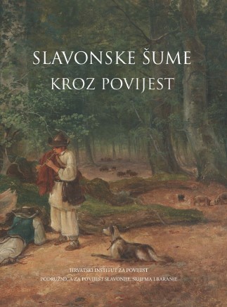
Wood was indisputably one of the most valuable natural resources of the Roman province of Pannonia. The southern part of the province, delimited by the Sava, Drava and Danube rivers, was no different. Though sporadically and briefly, several authors of the Principate period testify to the fact that this was a densely wooded area. Short notes from the literary accounts of Pliny the Elder and Appian of Alexandria are particularly instructive in this regard. No less valuable are the scattered archaeological remains which provide further evidence of the types of trees and their uses. Likewise, both stone inscriptions and figurative monuments shed some light on the complex human-nature relationship. This paper examines literary, archaeological and epigraphic records pertinent to the southern part of the Roman province of Pannonia, in an effort to offer a more coherent picture of forests and timber in the antiquity. Pliny’s mention of the acorn-bearing Pannonia suggests that the oak was the most prevalent species in the province. Referring to this area during the Roman conquests, Appian also pointed out that Pannonia was a wooded region. Others drew attention to the problem of human interventions in the environment. Forests and marshlands covered a considerable area in southern Pannonia, and soil amelioration measures were carried out on several occasions up to the modern times. Literary and epigraphic data implies that Pannonian forests were popular hunting areas for the local élite. Although direct proof of forest managment and ownership is yet to be found, two stone inscriptions unearthed in the north of the province indicate that the forests were either the emperor’s personal property, or were leased to local tenants. Archaeological excavations conducted in the urban centres of southern Pannonia showed that the first construction phase, dated to the early 1st c. AD, was predominantly marked by the use of timber. Classical authors refer to a whole range of different species used: oak, beech, fir, hazel, ash, alder, as well as different types of willow. Based on these reports, we can get a sense of how Romans used timber in the everyday life of the province. Votive monuments were used to examine the spiritual connection between the local population and the forests. It is worth noting that Silvanus was the second most popular deity in ancient Pannonia. The inscriptions and reliefs dedicated to him are regularly found not only in ancient spa centres, but also along the boundaries of private properties. It thus seems probable that the locals worshipped the deity as the protector of private estates on the edges of uncultivated wooded areas.
More...
The cartographic materials of various provenance and purpose are among the fundamental and irreplaceable sources for the studies of historic landscapes. Whether they are maps of larger areas, countries and provinces, or land maps containing information on the use of land in the vicinity of settlements, they represent an inexhaustible source of data to researchers of historical geography, topography, demography, ecohistory, microhistory, economic history, etc. The forests, as one of the most prominent environmental constituents and a key natural and economic resource, are present in all types of maps, regardless of the time of their creation. This allows us to say that all of our knowledge on the Slavonian forests in the past, as well as the potential of further research, is greater thanks to a relatively large number of maps kept in the domestic and foreign heritage institutions. In the holdings of the State Archives in Osijek there are a large number of such sources for the present-day East Croatia, from the mid-17th to the end of the 20th century. They are a part of several archival units, that is, fonds and collections. The most valuable are the maps of East Croatian manors and the collections of land maps of Slavonia and Syrmia. Also, there are a number of cadastral maps for the broader surroundings of Osijek, Virovitica and Vukovar. The Collection of geographical maps contains very interesting maps of Slavonia and topographic maps from the late 19th century. Some other archival units comprise of various valuable and interesting maps as well. Although the aforesaid materials are not entirely unknown to experts, a comprehensive systematic study of the maps has not been conducted yet. This especially refers to the data on the forests of East Croatia.
More...