We kindly inform you that, as long as the subject affiliation of our 300.000+ articles is in progress, you might get unsufficient or no results on your third level or second level search. In this case, please broaden your search criteria.
Inside the New Europe, proposed to reorganize based on cosmic principles instead of some arbitrary decisions, it’s possible to create five administrative-territorial unities, with grouping of the existent national states, -enclaves and –exclaves, of which functioning follows a damped harmonic oscillator model, taking part in the forming Eurasian Continental Unity. The Carpathian Chain being the terrestrial projection of the Constellation Draco/Dragon, with the included Ecliptic Centre represented by the Rosia Poieni Peak in the West-Carpathians, results of course the forming around it the Central-East European Territory, bordered by the Baltic Sea to the North, the Mediterranean Sea to the South, the Black Sea and the rivers Nistru-Bug to the East, and by the limits of the Central-West European Territory (former German-Roman Empire) to the West, with which together are forming the New Central Europe, surrounded by the West-, North- and East-European Territories, each of them with Northern- and Southern parts. Thus, the Central-East European Territory, called DRAKYA according to the Constellation, is separated by the river Danube-Drava in North-Drakya=DAKYA and South-Drakya=TRAKYA. DAKYA is relatively simple to realize, extending the V4 Association of Czech-land, Poland, Slovakia and Hungary with ROMANIA and MOLDOVA, respectively including the intercalated small teritories, but TRAKYA is more difficult to border inside the Mediterranean Sea. The coordinating centre of DAKYA results of course by cosmic criteria, through realizing of the new spatial town ROSIA POIENI, with residential and agreement zones on the surface, and with production and communal services in the depth, including a transatomic work too. A similar coordinating centre is possible to realize in TRAKYA at the Olympos Mountain, which is the projection of the Thuban, first star of the Constellation. In this conception, the functioning of the whole system is proposed with a periodicity of 5 years, started in 2020 with DRAKYA and TRAKYA, and from 2030 following with our western neighbours, and in order the West-, North- and East-European territorial ones, so in the next 100 years will be functioning the complete system with its mechanism based on equality, equilibrium and harmony, making certain the long-term evolution, after 2120 in cicles of 30 years. This transition from the „bulk” or atomized Europe to the proposed new structure, coincides with a transition process to a higher level of our consciousness, through a cosmic thought in general, inclusive in our renewed architectural and urbanistic thinking. In Europe’s restructuring based on cosmic principles, after their outside positions, ROMANIA and MOLDOVA will have a central position and coordinating role, with the possibility to catch up – or exceed – the more advanced European countries, restructuring their slender infrastructure and settlement network, as a result of their better situation in the domain of resources. In the realizing process of this grandious programme, a prime role will have the institution INCD-URBAN-INCERC, with its complex profile, able to coordinate on long term
More...
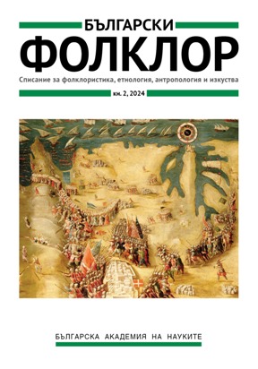
The paper discusses how features of the Volga River, the Lower Volga region, the Caspian Sea, and the adjacent territories are represented on 14th—16th century medieval European maps executed according to different cartographic traditions. In the 14th—15th centuries the ancient tradition was succeeded by a fundamentally new step: the appearance of the first nautical charts associated with the actual exploration of the Volga and the Caspian Sea regions by the Europeans. In this respect, Italian- and Catalan-style maps stand out for the manner the Caspian Sea and its adjacent area were represented. However, all of them are characterized by significant inaccuracies, although Italian-style maps are seemingly closer to the reality. The Turkish conquests of the 15th century greatly limited the penetration of the Europeans to the East, which led to the revival of the cartographic tradition that had stemmed from Claudius Ptolemy, and to the emergence of various compilations.
More...
Today, because of the population growth, the tendency on cities and urbanization increase gradually. Depend on these tendencies, the requirements of planning and location of the settlements and facilities areas on cities are came up with the migration from rural areas to urban areas. In this process, in addition to physical and environmental factors especially the socio-economic factors should be regarded as main component of sustainable urbanization. And also sustainable policies for urban development created by local governances have an effective role. Furthermore, determination of the urban development areas through the cities, land use and land cover structures are required as well. However, both the industrial areas, military facilities, public facilities areas are located in core of the cities even if without sub-scale urban land use planning. So these areas have to be re-allocated with urban regeneration projects to support for better urbanization. Based on the evaluations mentioned above, this paper outlines the requirements and criteria for location of urban regeneration areas. And also it is comprised to some approaches for integrated urban regeneration projects for provide the sustainability.
More...
The chapter presents several ecological and geographical considerations on and geospatial analyses of the eco-energy potential of Romania.
More...
The fundamental goal in approaching multimodality in transport is to integrate all modes of transport in an optimal, sustainable and ethical system. The implementation of intermodal services in the field of tourism will contribute to the increase of travel options, as well as to the provision of comfortable services, while increasing the efficiency of the transport system as a whole. The objective of the research is to identify and evaluate efficient IT solutions for calculating travel times in the integrated combined transport system of national road and rail infrastructure and the forecast demand in the field of public transport of people to tourist destinations. The proposed methodologies for defining IT solutions are based on the use of Geographic Information Systems, both in vector format corroborated with data on general transit specifications (GTFS) and in raster format by creating a continuous cost surface model, using all transport nodes.
More...
At the time of its greatest expansion, in the sixteenth and seventeenth centuries, the Ottoman Empire comprised the lower half of the land between the Drava and the Sava, previously part of the Hungarian-Croatian Kingdom. During the second half of the 16th century, the balance of power on that section of the new Ottoman border was established between the Ilova and Česma rivers, tributaries of the Sava, where a frontier zone was created, dividing the conquered parts (organized as Pakrac and Požega sanjaks) on the eastern side from the unconquered land (Croatia-Slavonia, as part of the Habsburg Empire) on the western side. There was no formal boundary line but rather a belt of “no man’s land”, a mostly depopulated stretch of land between the Drava and the Sava, which was from both sides carefully guarded by the crews of border fortresses. Through the use of written and subsequently also cartographic sources the author tries to show how this in the Middle Ages densely populated and economically well-developed area of the old Križevci and Virovitica counties became transformed into a deserted land where natural forces restored the primacy over the activities of human society. This “return to nature” manifested itself in the first place through unlimited growth of vegetation and ultimately natural reforestation – the growth of new forests throughout a relatively wide “march” or frontier zone. The Ottoman conquests in this area reached their limits in 1552 with the taking of important towns and fortresses of Virovitica near the Drava and of Čazma on the Česma river. The conquerors quickly established a new sanjak named Začasna after the medieval Croatian name of Čazma, Začesan or Začesemje (all forms meaning ‘beyond the Česma river’). However, they abandoned Čazma as soon as 1559 and moved the center of the sanjak to Pakrac, nearly 60 kilometers to the east. After the Slavonian-Turkish frontier zone finally stabilized around 1560, there were many episodes of the Kleinkrieg across the stretch of „no man’s land“ until the beginning of the seventeenth century. Turkish raids were certainly more frequent, but the Christian side repaid them in kind on a number of occasions. The organization of defense on the Slavonian side included the use of the abatis early on. In its decrees of 1562, the Croatian-Slavonian Sabor required the closing by barriers of river passes and the construction of wooden obstacles (resecandae indagines) at appropriate places. From then on, sources regularly refer to the use of abatis (indagines in Latin and Verhack or Waldverhack in German language texts) made by felling the trees in forested areas.
More...