
Around the Bloc: Duckwalking Mongolian Dinosour Rescued From Black Market
The specimen was so bizarre that scientists at first thought the fossil was a fake.
More...We kindly inform you that, as long as the subject affiliation of our 300.000+ articles is in progress, you might get unsufficient or no results on your third level or second level search. In this case, please broaden your search criteria.

The specimen was so bizarre that scientists at first thought the fossil was a fake.
More...
Generally, in the history books, coming to Anatolia of Turks are connected to Malazgirt Victory. If this date is taken as basis, it is assumed that before this date, there were not Turks in Anatolia. However, this preacceptance leads to misunderstanding of Turkish history. Moreover, this situation serves to weaken the ties of the Turks with their histories and Anatolian geography. With this dimension, it strengthens the argument that Anatolia belongs to other nations. However, recent researches and findings in various excavations reveal that this approach is not correct and that the Turks are based on ancient histories of the development of Anatolia. This study aims to further investigate of historians in this subject in order to remove the confusion in this subject. Thus, it is aimed to intensify the attention of historians to the subject. If this is done and both the country and the world committee are fed with the right information, it will be achieved for the purpose of work.
More...
Római kori sírsztéléken, síraediculák falán, szarkofágok oldalán nem ritka a tükrök, illetve a tükröt tartó személyek ábrázolása. Ezeket alapvetően hat nagyobb csoportba sorolhatjuk: 1. mitológiai jelenetek tükröt tartó Venus/Aphrodité-ábrázolással; 2. az elhunyt személy portréja – minden esetben nő – kezében tükörrel; 3. szépségápolás, testápolás során használt eszközök ábrázolása, köztük a tüköré; 4. sírépítmények jellegzetes ábrázolássémával: fiatal lány egész alakos figurája, egyik kezében tükörrel, a másikban kancsóval, dobozkával, kosárkával stb.; 5. szárnyas Geniusok kezükben tükörrel; 6. azon kivételes síremlékek csoportja, amelyeken kizárólag tükörábrázolást látunk. A felsoroltak közül a címben meghatározott területen az első, vagyis a szépítkező Venus ábrázolása, a második, az elhunyt személy portréját megjelenítő, továbbá a tükröt tartó lányalakot és a szárnyas Geniust ábrázoló típusok fordulnak elő. A szépségápolás során használt tárgyak változatos – ugyanakkor ismétlődő – sorát bemutató sírsztélék, bár birodalomszerte számos példából ismertek, Pannonia provinciából eddig nem kerültek elő.
More...
Den Gegenstand der Studie bilden zwei sog. „Benefiziarierabzeichen“, die im NO-Teil der Provinz Pannonia inferior, in Sárszentmiklós (Kom. Fejér) und Zsámbék (Kom. Pest), gefunden wurden, in je einem kaiserzeitlichen Wagengrab. Der Autor weist nach, dass diese Abzeichen ursprünglich an den begrabenen Wagen befestigt waren und die einstigen Wagenbesitzer (zugleich die vermutlichen Verstorbenen der Gräber) Unteroffiziere im principalis-Chargen (wie frumentarii, beneficiarii oder speculatores) waren, die man ins Statthalterbüro kommandiert hatte. Mit Hilfe dieser Tatsache konnte nicht nur eine neue, der Funktion nach gesonderte Gruppe der principalis - Abzeichen definiert, sondern auch die Reliefs anders beleuchtet werden, die principales auf ihren Dienstreisen auf dem Wagen sitzend darstellten. Auf Grund der nicht in direkt militärischem Kontext (z. B. in Gräbern, Heiligtümern) gefundenen Abzeichen hat der Autor versucht, einen Unterschied zwischen dem Eigentumsrecht der tatsächlich als Lanzenabzeichen getragenen und der nur mit Emblemen versehenen, meist zur Tracht oder Ausrüstung der principales gehörenden Kleinfunde (wie Fibeln, Gürtel- und Schwertriemenbeschläge) zu machen. Die Bestattung mit dem Wagen war aristokratischer Bestattungsbrauch der lokalen vornehmen Eravisker. So gehörten auch die Wagen besitzenden principales von Sárszentmiklós und Zsámbék zu dieser Stammeselite, die sich schon seit Ende des 1. Jahrhunderts zunehmend enger mit dem Heer verflochten hatte und seit der zweiten Hälfte des 2. Jahrhunderts das Statthalterbüro mit über gute Lokalkenntnisse verfügenden Unteroffizieren versah. Im Appendix der Studie werden auch vier neue Bronzebeschläge veröffentlicht, die zur Ausrüstung pannonischer principales gehörten
More...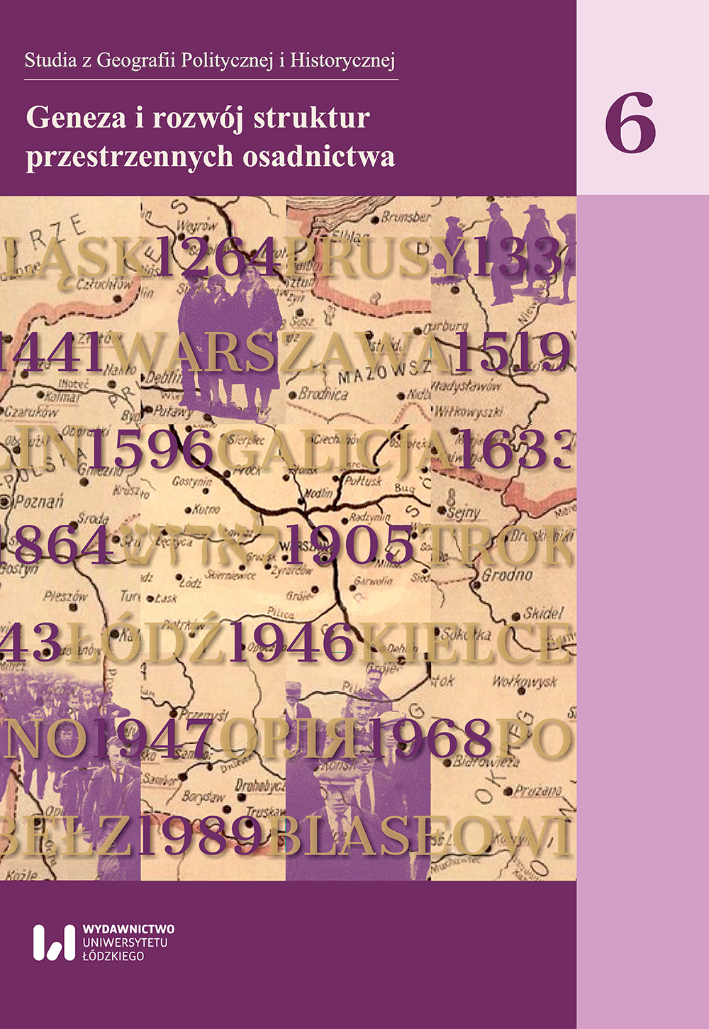

The paper presents the results of research concerning the currently non-existing villages of Wiączyń Polny and Leśny, where new Prussian colonies were created in the early 19th century. The development of settlements in the Middle Ages was studied, and the modern-period development was analysed against the legal and ownership relations. Both villages first appeared in historical sources in the 14th century and were part of the royal estate. For most of their history, they were leased by the nobility, with the longest-lasting being the Lasocki family. These were relatively small settlements, inhabited by serfs. Wiączyń had an inn and a grange, which included a mansion and farm buildings, including a brewery. The paper also attempts to reconstruct the layout of the village and to study the process of succession of settlement. Wiączyń Polny was an irregular roadand- square village, while Wiączyń Leśny was a multi-road village. As a result of Prussian colonisation, new villages were established in their place: Nowosolna, Wiączyń Dolny, Górny and Nowy. They were laid out in the form of regular linear villages, while Nowosolna took the form of a unique structure consisting of eight radial roads emerging from the centre.Artykuł przedstawia wyniki badań dotyczących nieistniejących współcześnie wsi Wiączyń Polny i Leśny, na terenie których na początku XIX w. powstały nowe kolonie pruskie. Zbadano rozwój osadnictwa w średniowieczu i dokonano analizy zagospodarowania w okresie nowożytnym na tle stosunków prawno-własnościowych. Obie wsie pojawiły się w źródłach historycznych w XIV w. i wchodziły w skład dóbr królewskich. Przez większość czasu swego funkcjonowania były dzierżawione przez przedstawicieli szlachty, przy czym najdłużej były w posiadaniu rodu Lasockich. Były to stosunkowo niewielkie osady, zamieszkane przez chłopów pańszczyźnianych. W Wiączyniu były zlokalizowane: karczma i folwark, obejmujący dwór i zabudowania gospodarcze, w tym budynek browaru. W pracy dokonano również próby rekonstrukcji rozplanowania wsi i zbadano proces sukcesji osadnictwa. Wiączyń Polny miał formę nieregularnej wsi drogowo-placowej, a Wiączyń Leśny miał charakter wsi wielodrogowej. W wyniku kolonizacji pruskiej na ich miejscu powstały nowe wsie: Nowosolna, Wiączyń Dolny, Górny i Nowy. Były rozplanowane w postaci regularnych wsi liniowych, przy czym Nowosolna przyjęła formę unikatowej struktury, składającej się z ośmiu promienistych dróg wychodzących z centrum układu.
More...
This theoretical-empirical article presents the results of the studies conducted by the author, aimed at solving the research problem focused on defining in a typological approach the types of the location of synagogues in the space of the settlement units of the Silesian Voivodeship. The article includes the review of the divisions of location of Silesian synagogues in the urban structures presented so far. Based on the author's analysis of cartographic and written materials, as well as the results of field surveys, the spatial relationships between the synagogues and the morphological elements of the towns occurring during the religious functioning of the synagogues were discussed. The final effect of the studies is the suggestion of the typology of the location of the synagogues in the structures of the settlement units of the Silesian Voivodeship. It takes into account the location of synagogues in relation to the most important (from the perspective of the socio-cultural conditions of Jewish settlement in this area) morphological components of different complexity levels, such as the area and elements of the old town foundations, 19th and 20th century urban layouts, squares, and Christian temples.Artykuł o charakterze teoretyczno-empirycznym prezentuje wyniki badań podjętych przez autorkę celem rozwiązania problemu badawczego, skoncentrowanego na zdefiniowaniu w formie ujęcia typologicznego rodzajów usytuowania obiektów synagogalnych w przestrzeni jednostek osadniczych województwa śląskiego. W pracy dokonano przeglądu dotychczas przedstawionych podziałów położenia śląskich synagog w strukturach urbanistycznych. Na podstawie dokonanych przez autorkę analiz materiałów kartograficznych i pisanych oraz wyników prospekcji terenowych omówiono związki przestrzenne zachodzące pomiędzy synagogami a elementami morfologicznymi miejscowości, jakie występowały w czasie religijnego funkcjonowania obiektów. Efektem finalnym przeprowadzonych badań jest propozycja typologii usytuowania synagog w strukturach jednostek osadniczych województwa śląskiego. Uwzględniono w niej położenie obiektów w stosunku do najistotniejszych składników morfologicznych o różnym poziomie złożoności, m.in. obszaru i elementów założeń staromiejskich, XIX- i XX-wiecznych układów urbanistycznych, placów, świątyń chrześcijańskich.
More...
The paper is focused on the economic problems of de facto states in the post-Soviet space after Russia's annexation of Crimea in 2014, creation of the Eurasian Economic Union in 2015 and the signing of the Deep and Comprehensive Free Trade Agreement between the EU and Georgia and Moldova with effect from 2016. It analyzes long-term economic strategies of Transnistria, Nagorno-Artsakh, South Ossetia-Alania and Abkhazia in the context of such changes. On the basis of statistical analyzes their economic problems, which are closely connected with developments in Russia and its geopolitical interests.Artykuł koncentruje się na problemach ekonomicznych państw de facto w przestrzeni postsowieckiej po aneksji Krymu przez Rosję w 2014 r., utworzeniu Eurazjatyckiej Unii Gospodarczej w 2015 r. oraz podpisaniu pogłębionej i kompleksowej umowy o wolnym handlu między UE a Gruzją i Mołdawią wchodzącej w życie od 2016 r. Poddaje analizie długoterminowe strategie gospodarcze Naddniestrza, Górskiego Arcachu, Południowej Osetii-Alanii i Abchazji w kontekście tych zmian. Bazując na danych statystycznych i innych informacjach poddaje analizie ich problemy gospodarcze, które są ściśle związane z rozwojem sytuacji w Rosji i jej geopolitycznymi interesami.
More...
The main objective of the article – to show the different trajectories of the cultural landscape in controlled and uncontrolled parts of the war-torn Donbas. The cultural landscape of Ukraine significantly changed during the twentieth century. The main factors of these transformations were ideological, military and geopolitical. The sub-ordinate position of Ukraine within the USSR allowed communist leaders to enforce sovietisation of the cultural landscape. This policy was especially noticeable in the great industrial region of Donbas. Achievements of independence by Ukraine and democratization of country' public life have led to transformation/conservation of the cultural landscape, which corresponded with political culture of individual regions. The war in the Donbas has become a catalyst for the processes of creating different types of cultural landscape on the different sides of the contact line. The policy of creating a cultural landscape has become an instrument of political socialization and mobilization of the population. This process is not complete, and can contribute to the crystallization of new subregional identities on different parts of contemporary Donbas.Głównym celem artykułu jest pokazanie różnych trajektorii krajobrazu kulturowego w kontrolowanych i niekontrolowanych częściach rozdartego wojną Donbasu. Krajobraz kulturowy Ukrainy znacznie się zmienił w XX w. Główne czynniki tych przemian mają charakter ideologiczny, wojskowy i geopolityczny. Podporządkowana pozycja Ukrainy w ZSRR pozwoliła przywódcom komunistycznym na egzekwowanie sowietyzacji krajobrazu kulturowego. Polityka ta była szczególnie widoczna w wielkim przemysłowym regionie Donbasu. Osiągnięcia niepodległości przez Ukrainę i demokratyzacja życia publicznego w kraju doprowadziły do transformacji/zachowania krajobrazu kulturowego, który odpowiadał kulturze politycznej poszczególnych regionów. Wojna w Donbasie stała się katalizatorem procesów tworzenia różnych typów krajobrazu kulturowego po różnych stronach linii styczności. Polityka tworzenia krajobrazu kulturowego stała się narzędziem politycznej socjalizacji i mobilizacji ludności. Proces ten nie jest kompletny i może przyczynić się do krystalizacji nowych subregionalnych tożsamości w różnych częściach współczesnego Donbasu.
More...

This article presents a vision of the history of Warmia and Masuria created by the Social Realist propaganda. The author proves that social realist writers and poets made the Polish language a symbol of the Polish identity of the inhabitants of Warmia and Masuria. For this purpose she inspects who and in what circumstances used the Polish language, in what way people expressed their commitment to the language, and what value it had for the people living in former East Prussia. Sheshows that it was Polish schools, teachers, magazines, folk artists as well as peasants that played a special role. The author analyzes poems and short stories written in the time of Social Realism which were to prove the forever-lasting Polish identity of the Regained Territories.
More...
Diese Studie beschäftigt sich mit der Frage, ob die in der ptolemaischen Geographica unter den Völkern des südosteuropäischen Steppengebietes erwähnten Hunnen mit den Hunnen des Jahres 375 identisch sind. Aus einer eingehenden Analyse der ptolemaischen Angaben und einem Vergleich mit späteren Quellen (Orosius, Ammianus Marcellinus) ergibt sich, dass bei Ptolemaios kein Fehler unterlaufen ist und dass wir zu Beginn des zweiten nachchristlichen Jahrhunderts tatsächlich mit einem hunnischen Volk am östlichen Rand des Karpatenbeckens rechnen müssen. Schon zu dieser Zeit zeigt sich eine hunnisch-alanische Nachbarschaft, die erst im letzten Viertel des vierten Jahrhunderts voll zur Entfaltung kommt. Dieses Bündnis war es nämlich, das zusammen mit Teilen der Ostgoten während der Wirren nach 375 nach Pannonien zog und dort als römische Föderaten eine gewisse historische Rolle spielte. Die Hunnen, die sich um 380 in Pannonien ansiedelten, waren also keine abtrünnigen Abteilungen der um 375 siegreich nach Westen vordringenden Hunnen. Der Volksname selbst aber konnte als ein politisches Programm für die Flüchtigen dienen.
More...
Les chapitres du Kitāb al-masālik wa-l-mamālik d’Abū (Ubayd al-Bakrī concernant le sud de la péninsule arabique (Yémen et (Umān) nous livrent une matière importante et originale. D’abord, ils témoignent de l’aspect compilatoire de tout l’ouvrage quoique l’auteur ait réorganisé son matériel selon un ordre particulier. S’il y a des redites, l’un des mérites de l’ouvrage est néanmoins d’avoir conservé des textes perdus par ailleurs, c’est notamment le cas des itinéraires du Yémen dont on peut en grande partie identifier les toponymes et les directions. En outre, ils donnent aussi des remarques sur l’habitat ou des usages particuliers qui attestent de la réalité des observations de ou des informateurs. Enfin, il nous semble qu’un faisceau d’indices désigne al-(U7rī, maître d’al-Bakrī, comme source principale de ces chapitres. Quoi qu’il en soit, ces pages renseignent tant sur le sud de la péninsule arabique au 5ème/11ème siècle que sur l’histoire de la littérature géographique arabe.
More...
This paper analyses the character and the status of the rule of a former Byzantine Empress Maria, Margaret Árpád and her sons over the area of southern Hungary after Margaret’s return to Hungary from the Kingdom of Thessalonica (around 1222). Margaret’s lands and properties can be divided into two groups based on their respective status. The first group includes properties in the South of Hungary that were given to her in 1223, or a year earlier, by her brother, Hungarian King Andrew II. Among others, this group included the entire County of Kovin (Castrum Kewe cum toto Comitatu...), as well as lands in Syrmia. On the other hand, Margaret was also mentioned at the beginning of 1229 in a famous letter by Pope Gregory IX as a ruler of Upper Syrmia (Sirmia Ulterior) – the lands South of the river Sava, which would later be named Macsó. This territory was inhabited by Orthodox Slavs and Greeks. The same source indirectly gives rise to the claim that Margaret gained Upper Syrmia (Sirmia Ulterior) in connection with, or even in favour of the part of Hungary called Lower Syrmia (Sirmia Citerior). It is known that this was the Syrmia which was located between the rivers Danube and Sava and in which the Hungarian rule and the Duchy of Syrmia had already been established. It is historiographically accepted that Margaret was the ruler of both Upper and Lower Syrmia, whereas it is believed that her sons, the elder John Angelos and possibly his younger step-brother, William of Saint Omer, inherited the rule of Upper Syrmia. This was also indicative of their title Dux and Dominus Sirmii/Syrmie. However, based on an analysis of the archontology of Hungarian government dignitaries, the author of this paper concludes that they also had dominion over Lower Syrmia and the Duchy of Syrmia. Namely, between 1222 and 1253 there is not a single piece of data about the existence of a Duke in the Duchy of Syrmia or any information about the work of the Duchy’s institutions. Meanwhile, neighbouring areas that surrounded Syrmia between the Danube and the Sava, including Lower Syrmia (before 1229 and after 1242), the County of Kovin (1222–1235), the County of Bács (before 1238 and after 1242) were all under the rule of Margaret or her son, John Angelos. Historiography also unanimously agrees that Upper Syrmia can be identified as part of the dowry (dos) “given” to Margaret by her father, Béla III of Hungary, on the occasion of her marriage to Isaac II Angelos (1186). This area once more came into the possession of Margaret and her family upon her return to Hungary. This was the second group of Margaret’s lands and properties connected with her dowry. Božidar Ferjančić proposed that it was precisely Margaret’s dowry and the rule over Lower Syrmia, which resulted from it, that represented the last sign of the Byzantine legacy in these frontier lands. This thesis gives rise to the issue of the status of the remaining territories in the possession of Margaret and her heirs, which, in the opinion of the paper’s author, can also be viewed in the wider context of the Byzantine legacy. Margaret gained the County of Kovin, situated along the border, not only as a mere appanage, but as a territory that was to serve as a strategic foothold for the acquisition and strengthening of her authority over the areas South of the Danube and the Sava (Belgrade, Braničevo), which had once been part of her former dowry. When Andrew II crowned his younger son Coloman King of Galicia, as the base for the acquisition of this country he gave him the neighbouring County of Sepesz (1216–1226), whereas in the late 1250s young Hungarian King Stephen received the County of Zala from his father Béla IV, as a foothold for his rule in Styria. It would seem that Margaret’s and her sons’ rule over Lower Syrmia was acquired in the form of a dynastic property and a particular honor, i.e. they independently managed the revenue and the lands of the Duchy of Syrmia. This is indirectly supported by the first piece of data about the Duchy of Syrmia that appears after the disappearance of the family from the historical stage, when, in a document from 1253, it was stated that a Catholic archbishop governed “totam Sirmiam no solum honore comitatus” in the king’s name. John Angelos outlived the Mongolian invasion, having died before 5st of July 1250. Unlike the Counties of Kovin and Bács, over which John Angelos presided as a Duke (having the status of a state dignitary appointed by the ruler), we have no such data for Syrmia. This is why the author of this paper believes that John Angelos’s title of the ruler of Syrmia referred not only to Upper, but also to Lower Syrmia. Unlike the County of Kovin and other lands that were given to Margaret and then returned to the ruler after her death, Syrmia is not mentioned in the grant from 1223, nor was it later given over to her sons’ rule as a Duchy. It appears that it was kept as Margaret’s personal property which was later inherited by her sons. Therefore, it is possible to conclude that Lower Syrmia was also tied to Margaret’s dowry in its status. This assumption is, however, contradicted by a known fact that, unlike Upper Syrmia, Lower Syrmia was not among the lands that were returned to Byzantium as part of Margaret’s dowry after it was taken by Béla III (before May 1182). Margaret was the de facto ruler of both Syrmias, but it is not known if she had a title. It were only her sons who bore the titles of dux and dominus of Syrmia. The title of dominus was quite possibly modelled after the title of urum-despotes which had once belonged to Béla III when he was the Crown Prince of Byzantium (and Hungary). This was one more sign of the Byzantine influence which came to Hungary alongside Margaret and her sons and which was maintained among the members of the dynasty (Duke Rostislav Mikhailovich and his family). A real development of the institutions in the Duchy of Syrmia began only in the second half of the 13th century. Until then, in its place stood the rule of the family of the former Byzantine Empress, Margaret.
More...
It is considered that karstology; the science that deals with soluble rocks; begins as a separate discipline with the dissertation of Jovan Cvijić "Das Karstphänomen" (1893). During the 20th century karstology has developed and deepened mainly as part of the geography; geology and hydrology; and in the 1950’s has found strong application in technical sciences; particularly construction; forestry and agriculture. At the end of the 20th century; Czech karstologist Vladimir Panoš (1995) defined karstology as an independent; integrated system of individual branches that are taking a complex research in areas covered with rocks of different degrees of solubility. His definition provides a platform for versatile karstology and approach to solving all the problems that appear on the karst. The paper provides an overview in scientific and management activities in the Dinaric karst which refer to such defined karstology and a current rating of affirmation such perceived karstology in its homeland 120 years after its creation.
More...
The study examines the extant Sasanian material relating to geographical knowledge, trying to answer the question whether Iranians of the Late Sasanian period possessed the notion of “geographical science” comparable to that of their Byzantine neighbours or their Islamic heirs. Geographical traditions found in several texts, both in Avestan and Pahlavi, are studied and compared, in order to reach the conclusions, whether the actual geographical knowledge was systematised. It appears that there was much diversity in geographical views in various periods of Sasanian history; the views on geography were generally geopolitically motivated; there was a gap between the learned traditions and real geographical knowledge; Sasanian geographical attitudes were characterized by Iranocentrism and little interest in real geography; Sasanian Iranians did not develop a geographical science, and much of what we are left with is rather geographical mythology.
More...
Ibn al-Qass (m. 335-336/946-947) nous a laissé une description du mont Sinaï extrêmement riche en détails et proche de celle d’al-Bakrî (m. 487/1094). Si la plupart des observations sont confirmées par ailleurs, un élément tranche par sa nouveauté : la présence, au sommet, d’une belle et grande église. Vraisemblablement d’époque justinienne, elle aurait été construite juste après le monastère et est identique à celle visitée par les pèlerins occidentaux du Moyen Age. Enfin, le texte parle d’énigmatiques Banü Ramad et témoigne de la réduction du nombre des moines vivants au monastère à cette époque.
More...
Nazwy miejscowe (tzn. nazwy miast i wsi) można badać i objaśniać z dwu różnych punktów widzenia. Pierwszy z nich to typ (rodzaj) motywacji, czyli, z grubsza rzecz biorąc, etymologia nazwy, drugi natomiast to językowy (słowotwórczy, a ściślej: nazwotwórczy) mechanizm powstania nazwy. Badania drugiego rodzaju stanowią domenę językoznawców i poza ich kręgiem nie budzą większego zainteresowania. Natomiast badania zmierzające do odtworzenia pierwotnej motywacji nazwy, czyli jej etymologii, zostały – przynajmniej na polskim gruncie – zainicjowane przez historyków, którzy spodziewali się dzięki nim uzyskać ważne dane do dziejów osadnictwa i szerzej – kultury materialnej i społecznej. Ostatecznie, ze względu na przedmiot, którym są nazwy, a więc elementy składowe języka, badania te znalazły się w obszarze kompetencji językoznawców, w obrębie językoznawstwa zyskały jednak status odrębnej, autonomicznej dyscypliny lingwistycznej, jaką jest onomastyka (nauka o nazwach własnych), której specjaliści w szerokim zakresie współpracują z historykami, archeologami, socjologami, geografami (specjalistami z dziedziny geografii historycznej) itd.
More...
The Obrovac type-sites are most frequently preserved in the form of small hills surrounded by a wide ditch. According to the published data, they are present only in western Serbia. The first researchers assumed that prehistoric inhabitants covered the space inside the ditch with dug earth in order to protect the settlement from floods. Until now, this hypothesis could not be tested due to insufficient research. During the research of the site of Šanac-Izba in Lipolist in 2013, one of the goals of the research was to reevaluate the old hypothesis of the formation of the Obrovac type-sites. This was accomplished in two steps. Firstly, the creation of the hypothesis itself was reconstructed, and then, the stratigraphy of two sites, one of which was excavated almost four decades ago, and the other within a new project, was compared.
More...
First part of this article presented an overview of the ancient texts about sailing on the Dead Sea, conditions of this sailing, iconographie sources and the first group of the direct archaeological evidences, that is, anchors found around the Dead Sea. The second part of this paper is paid to research on ruins identifiable as the remains of the marinas or ports on the Dead Sea (Ma’aganit ha-Melach, Khirbet Mazin, Mezad Gozal) and presents also hypotheses about possible locations of this kind of constructions in antiquity, after which no traces are preserved or found (En Gedi, Ein ez-Zara — Kalliroe, Masada, Mint el-Mazra’a, Wadi Numeira, mouth of the Jordan river).
More...